[ad_1]
Thanks to its range of exclusive electromagnetic acquisition technologies, the Breton company MAPPEM Geophysics has developed a very broad range of services, focused on the imaging of electrical resistivity, but also the detection of objects buried in marine sediments, or the measurement of electromagnetic fields produced by infrastructures such as offshore wind farms.
Measuring the electromagnetic response of the seabed to better reveal its structure… This is, in essence, the innovative approach behind the creation of MAPPEM Geophysics. A spin-off from the University of Brest, the young company based in Saint-Renan, near Brest, was co-founded in early 2015 by former CNRS engineer and doctor in physics and electronics Jean-François D’Eu, alongside Pascal Tarits, university professor in marine geophysics, expert in electromagnetic imaging methods applied to geosciences. Current president and scientific advisor of the company, the two men built their entrepreneurial project on solid scientific bases, resulting from academic research work relating to indirect prospecting techniques by imaging resistivity, used for a long time on dry land. Techniques at the head of which is the magnetotelluric method.
“This method uses the measurement of natural fluctuations in geoelectric and geomagnetic fields to determine the impedance of subsoils”specify the inventors (among whom are Jean-François D’Eu and Pascal Tarits) of a patent filed in 2006, herald of the innovations carried today by MAPPEM Geophysics. A “basement impedance” which in turn makes it possible to determine the electrical conductivity – which varies greatly depending on the nature of the rocks – of each of the geological units which follow one another under our feet, and thus to precisely reveal their structure. An effective approach, at least, on dry land…
From land to sea
” The methods electromagnetic originated on land, where they have long been used in the field of geophysical imaging, but our two co-founders are among the few players who are contributing to their transposition at sea.explains data geoscience doctor Andrew Weller, head of business development at MAPPEM Geophysics.
However, these methods remained reserved for deep imaging of structures located several kilometers below the surface. For the more “coastal” needs of the industry, the development of renewable marine energies in particular, it was necessary to develop specific tools. This is what Jean-François D’Eu and Pascal Tarits did by developing an eponymous device from the company they co-founded: MAPPEM, for “Marine profiler with penetrating electromagnetics”.

A cable and two “fish”…
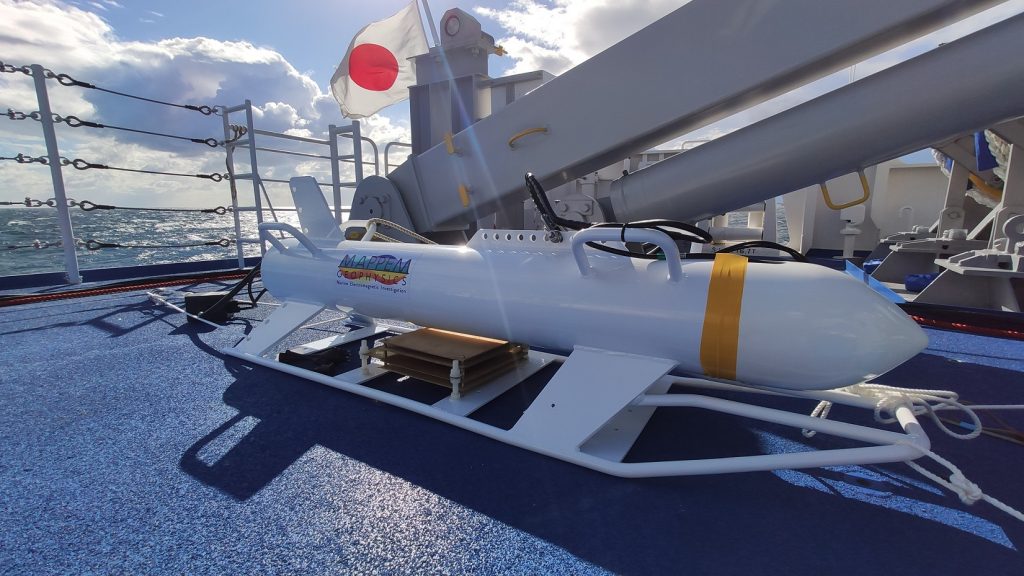
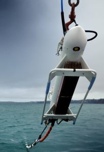
“MAPPEM is a resistivity imaging system towed by a ship near the bottom at a speed of approximately 3-4 knots”describes the Brest company on its website. An imaging system composed of two “fish”, which look like torpedoes, containing the components necessary for the acquisition of a signal which allows, after processing via the algorithms developed by MAPPEM Geophysics, to draw up the profile of the entrails under -marines.
To generate this signal, the device injects a current of several tens of amperes between the two fish, a current which thus penetrates deep into the seabed. The result is the generation of an electromagnetic signal then captured by twenty electrodes distributed behind the lead fish.
It is precisely this signal which allows, via in-house algorithmic processing, called FASTINVto finally obtain a resistivity model revealing the geological structures underlying the seabed, in near real time.
“To achieve this, we have done a lot of work to improve our processing algorithms”underlines Andrew Weller. “When you are on board the ship [tractant le dispositif]you can observe the results of the acquisition process almost live »illustrates the manager.
And in addition to this important work completed in March 2022, the MAPPEM Geophysics team of engineers set about developing other innovations, enriching the company’s range of technologies over the years: PASSEM and STATEM, two systems measuring ambient electromagnetic fields emitted by underwater structures of anthropogenic origin such as offshore wind farms; MAPPEM-S – “light” version of MAPPEM adapted to acquisition in shallow water depths – but also an ultimate electromagnetic imaging device working not only in two, but in three dimensions, and thus aiming at detection of buried objects.
From 2D to 3D

“Based on MAPPEM technology, we have developed another electromagnetic imaging device, this time in three dimensions: MAPPEM-3D”, reveals Andrew Weller. Taking up the foundations of the MAPPEM system which are the two “fish” towed by a boat, the solution is different in that it does not include one but three cables equipped with receiving electrodes. “This is what makes it possible to obtain a system ofacquisition 3D » enlightens the company’s business development manager.
Still aiming for a real-time acquisition objective, MAPPEM Geophysics has developed another algorithmic processing system for the signals captured by the electrodes, called BODIES.
“This 3D system allows us to detect and precisely locate point objects”, explains Andrew Weller. Objects including “UXO”[1] ”, or unexploded ordnance. “These are often remnants of the Second World War, which pose a significant threat to marine renewable energy projects”illustre Andrew Weller.
Enough to further enrich the range of services offered by MAPPEM Geophysics and the range of sectors it addresses: dredging, oil & gas, geothermal and renewable energies, but also defense and scientific research. “We have the possibility of doing a lot of things…!” »glisse Andrew Weller.
All-round projects
Since its creation in 2015, the Breton company has carried out no less than forty projects alongside around thirty clients including, in particular, several companies in the marine renewable energy sector. In addition to the precise determination of the lithology of the seabed – which can go as far as the identification of a possible alteration of subsurface rocks – MAPPEM Geophysics technologies allow future operators of wind farms to ensure the absence of other geological risks: cavities, gas pockets, or even rocks buried beneath the surface, more difficult to detect using conventional geophysical techniques.
Geological hazards, but also bombs, as mentioned above by the company’s business development manager. Munitions which were precisely at the heart of one of the most important projects carried out to date by MAPPEM Geophysics. “As part of the installation of an offshore wind farm off the coast of the Netherlands, we carried out an electromagnetic survey mission aimed at drawing up a map of the risk of the presence of bombs in the area concerned. More precisely non-ferrous munitions, mainly aluminum mines, which are however usually very difficult to detect.describes Andrew Weller.
A large-scale project carried out abroad, a sign that MAPPEM Geophysics does not confine its activities to the Breton coastline where it was born… “There are great opportunities to be seized abroad! »assures its business development manager, who is targeting the English and Scandinavian markets, but also, why not, the American and Australian coasts.
[1] Unexploded Ordnance
[ad_2]
Source link